
 Someone needs to tell us where to park on Route 31. Seriously, we couldn’t find the LHHT Trailhead Parking Lot to drop off our “finish car.” But that’s because our pre-hike parking preparation went like this:
Me: Pat, the trailhead overnight parking lot is on Route 31. Do you know where that is?
Pat: Yeah, I think so.
Note to all, when your significant other says, “I think so,” it likely means, “No, but I think I can wing it.”
We didn’t wing it very well. I ended up following my husband onto a road completely unrelated to Route 31, waited 15 minutes in a farmer’s driveway while my husband consulted his GPS, followed him down a dirt road for several miles, but had to suddenly stop my car to resolve a desperate problem involving the consumption of too much coffee that morning, miraculously caught up with him and even more miraculously came out on Route 31, turned left and parked in the first parking lot we saw, which we realized 48 hours later when we were 18 miles into the trail, was NOT the trailhead overnight parking lot. But that’s where we left our car.
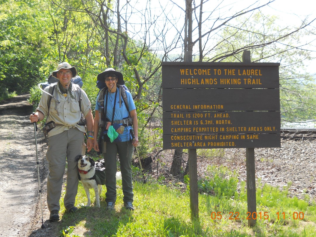
Fortunately, we found our starting point in Ohiopyle just fine. Pat dropped me and Sparky off at the trailhead at the end of the Wilderness Voyageurs road, parked in the overnight lot, registered at the Park Train Station and we hit the trail at 11AM, at least an hour later than we expected to start.
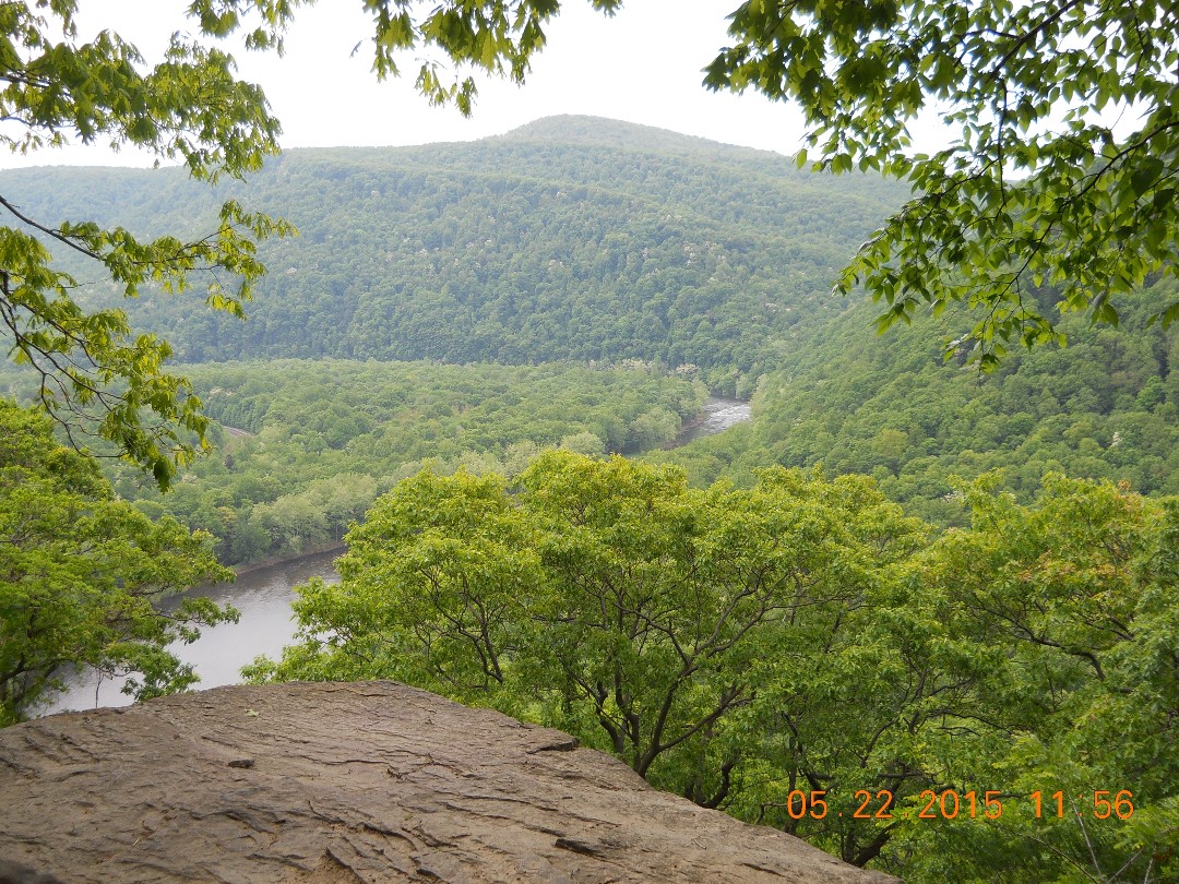
No problem. We had all day and only 6 miles to hike our first day. I had picked up two Laurel Highlands Hiking Trail maps at the beginning of the trail, and had the presence of mind to study the map while waiting for Pat. It was a good thing, because not 15 minutes into our hike, I lost one map, which slipped out of the straps I tied around it. Then when we took a break at a scenic vista near the top of the first steep climb, apparently known as the first of two Dolly Parton Peaks, the second map flew off the side of the cliff in a gust of wind.
So essentially, what remained in my memory was the only map we would have to consult for the next 29 miles, which makes me wish I had studied harder, just like high school chemistry.
I found it takes some getting used to hefting a 35-pound pack on your back. Pat’s was heavier, but since Sparky only had to carry his own dog food and snacks, he was the one who got off easy. We tried sneaking a brand new, unused, pooper scooper into one of his side packs, but that was enough to throw off the weight distribution so that his doggie pack kept sliding down his left flank for the first few miles. Then, at mile 5, Sparky started heaving and although it looked to me like he was about to barf up a belly-wad of wild grass, he instead made a lurching motion and cleverly stepped out of his backpack, leaving it behind. Pat kindly picked it up and carried it the rest of the way that day, which smart Sparky had bargained on, but which forced us to cinch it tighter from then on.
(Sorry Sparky.)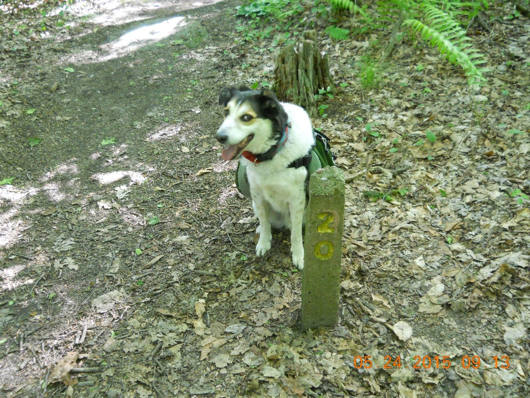
Our itinerary was this:
Day 1 – Ohiopyle to Ohiopyle Shelters – Mile 6.3
Day 2 – Ohiopyle Shelters to Route 653 Shelter Area – Mile 18.5
Day 3 – Route 653 to wherever our car was parked on Route 31 – approximately Mile 31?
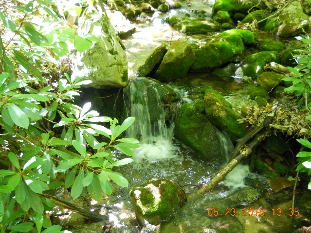 The LHHT is clearly marked with yellow blazes, well maintained and easy to navigate. Every mile is spectacularly beautiful with woods, creeks, rocks, cliffs, meadows and even one pretty, little lake near Mile 14.
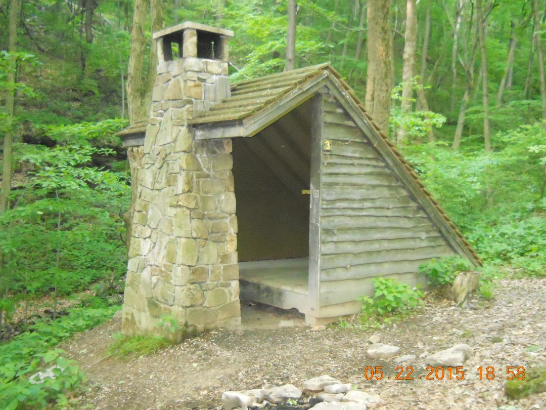
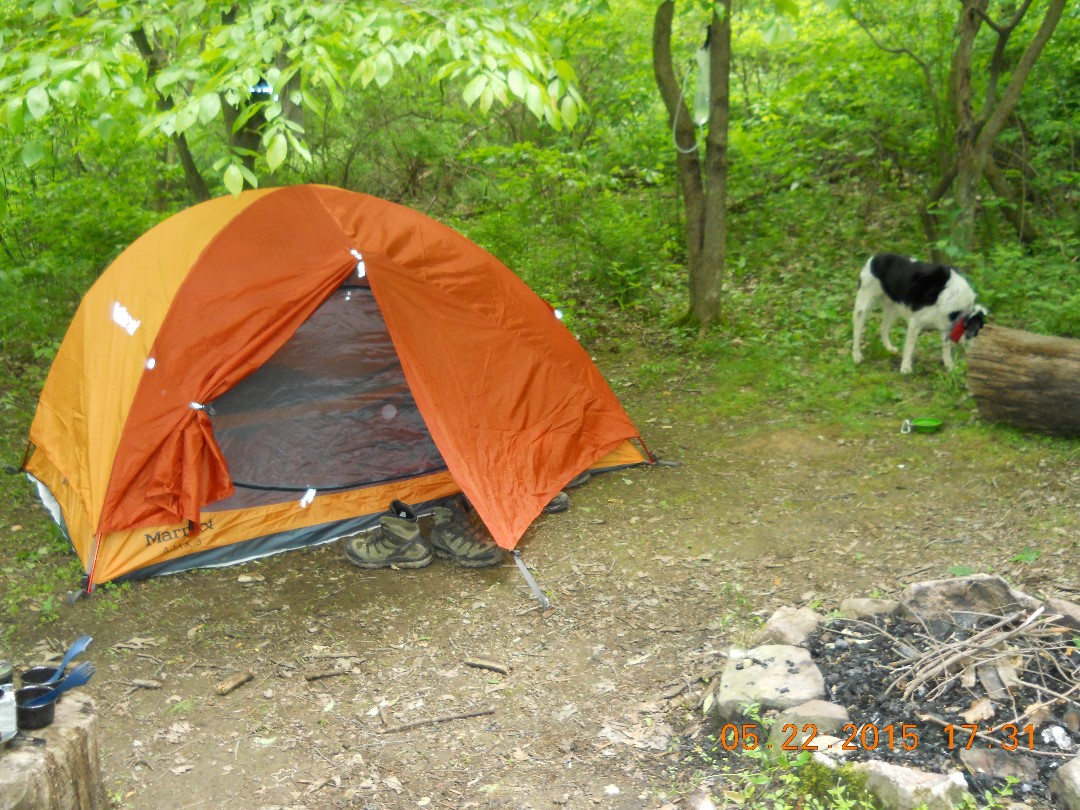
We opted to sleep in a tent each night, but each shelter area also has wooden, lean-to-style shelters with a fireplace and hooks on the walls, which look appealing, but which, in my mind, would be overrun with field mice every night. I don’t know if that’s the case, but it was enough to make me grateful for our lightweight tent, which at least offered excellent protection from bugs, which I was always delighted to see on the OUTSIDE our tent.
No matter where you sleep, you are required to make an online reservation, which costs $4 per person. If any freeloaders out there think they might be able to sneak in, stay the night and slip out in the morning undetected, I must warn you that at the Ohiopyle Shelter, it was just turning dark, and, tired from the strain of parking and hiking, we had just crawled into our tent and started to fall asleep when I distinctly heard someone ask, “Are you registered under Ann?”
My instant, half-conscious, confused response was, “Yes?”
“Okay, you don’t need to come out of the tent,” said a disembodied voice.
In my groggy state, I was thinking hard, trying to figure out why someone would tell us we didn’t need to come out of the tent, but Pat quickly determined it was The Ranger.
So come on, people: PAY TO STAY.
There is one long, nearly 2-mile slog of a climb from the Ohiopyle Shelters to the top of the ridge. The first mile in particular is very steep and I felt bad that Pat left his hat a quarter mile down the trail at our first water break and had to remove his pack and run down to retrieve it. Sparky eagerly ran down with him, pooper scooper, pack and all, without understanding that this was not a hill any man or beast would want to climb twice in a morning. I was the lucky one who got an extra break to conserve my energy. Once we were up on the ridge, the rest of the trail was much less strenuous. Gradual inclines, with only a few short, steep climbs up or down. With full backpacks, we were able to fairly consistently hike about 2.5 miles per hour, sometimes nearly 3.
We plan on doing the rest of the 70-mile LHHT later this summer, starting at our end point on Route 31 and heading north toward Johnstown. I can’t wait!
But this means we still have to figure out where the heck we’re supposed to park.
6 Comments
Great story, Ann! Glad to hear (read?) that you and Pat are out and about enjoying your life. Looks like beautiful scenery too!
Cindi, it was a fabulous trip – Pat’s first time backpacking. I’m ready to hit the trail again!
Great story, Ann! Glad to hear (read?) that you and Pat are out and about enjoying your life. Looks like beautiful scenery too!
Cindi, it was a fabulous trip – Pat’s first time backpacking. I’m ready to hit the trail again!
It’s a beautiful trail. Hope you hike and enjoy it! Ann