
 The most significant thing that has changed since we hiked the first 31 miles on the Laurel Highlands Hiking Trail in May is that for the first time in 25 years, a man in Pennsylvania died after being bitten by a rattlesnake.
Okay, he wasn’t hiking the LHHT, but this news still disturbed me because I have seen more snakes in the past 3 months than I’ve ever seen in my life. Not rattlesnakes, but snakes nonetheless, all of which have caused me to jump, shriek, shiver and beg my husband to make it go away.
He says I’m dramatic. I keep telling him he is missing the point of the Adam and Eve saga.
Anyway, I knew I was going to be on full rattlesnake alert on this quick overnight trip to cover the next 15-ish miles from Route 31 to Route 30.
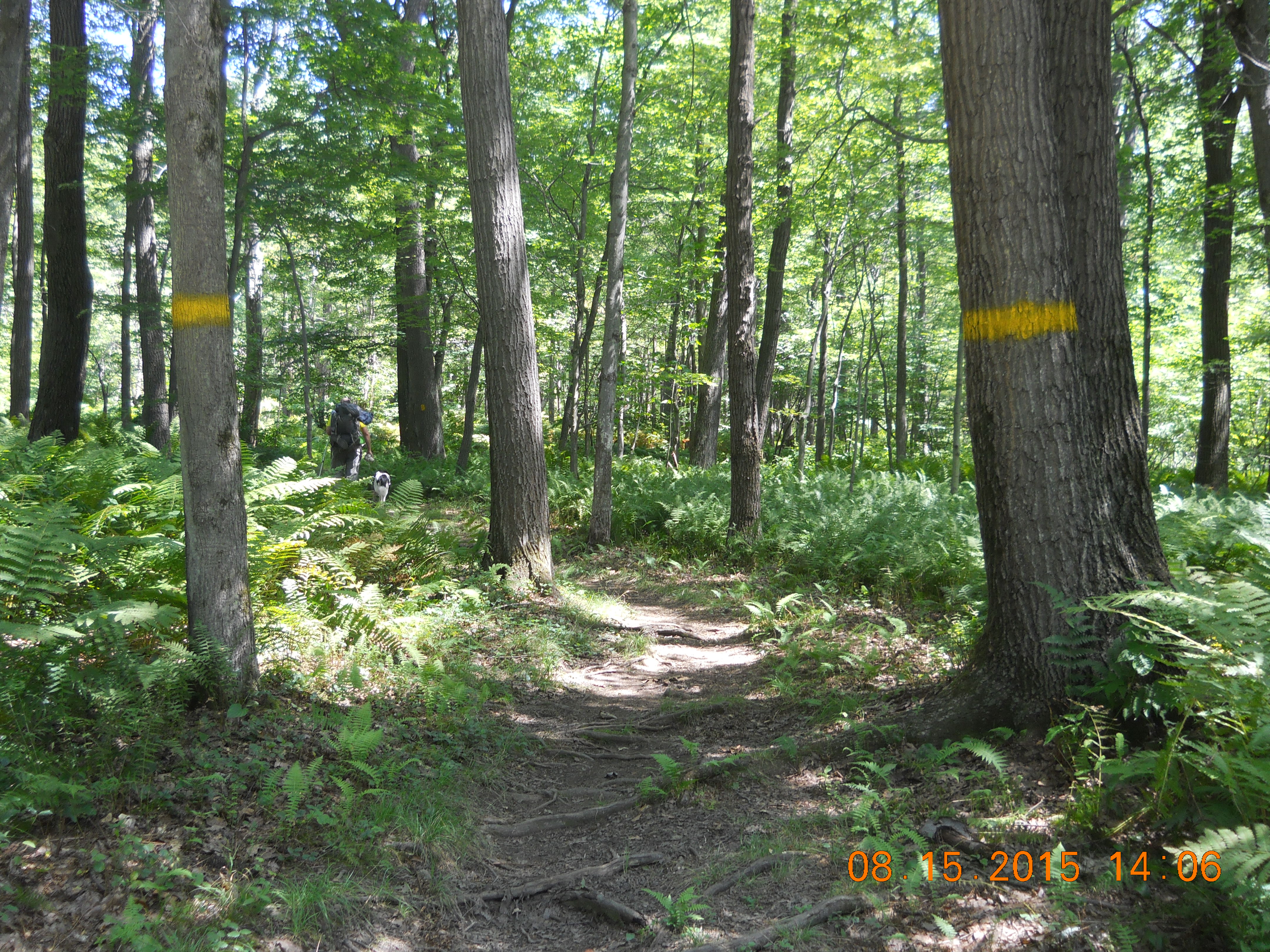
Every mile I hike on the LHHT, I marvel at how meticulously well-marked it is. I’ve hiked all my life, starting as a child in the mountains of California. It’s amazing how long I lived before I ever noticed or cared about trail blazes. But after hiking the Rachel Carson Trail in Western Pennsylvania, I can tell you that trails exist that are so randomly blazed and confusing that after walking in circles for hours, it is possible to be so lost that you worry a search party won’t be able to follow the trail long enough to rescue you.
This makes me appreciate the abundance of yellow blazes on the LHHT. You could practically walk the entire trail with your eyes closed, opening them every 10 steps to see the next yellow blaze. Don’t do this, of course, because you couldn’t take two steps before you tripped on a rock, root, or God forbid, a rattlesnake. But my point is that I don’t know how you could possibly get lost on this trail. Without the blazes, there would be numerous opportunities to stray, especially in Laurel Ridge State Park, where there are lots of other trails and roads that crisscross the LHHT. But every time you reach an intersection on the LHHT, the wonderful trailblazers painted even bigger, bolder yellow lines on trees on both sides of the trail to notify you that you are at an intersection and to stay on the yellow path.
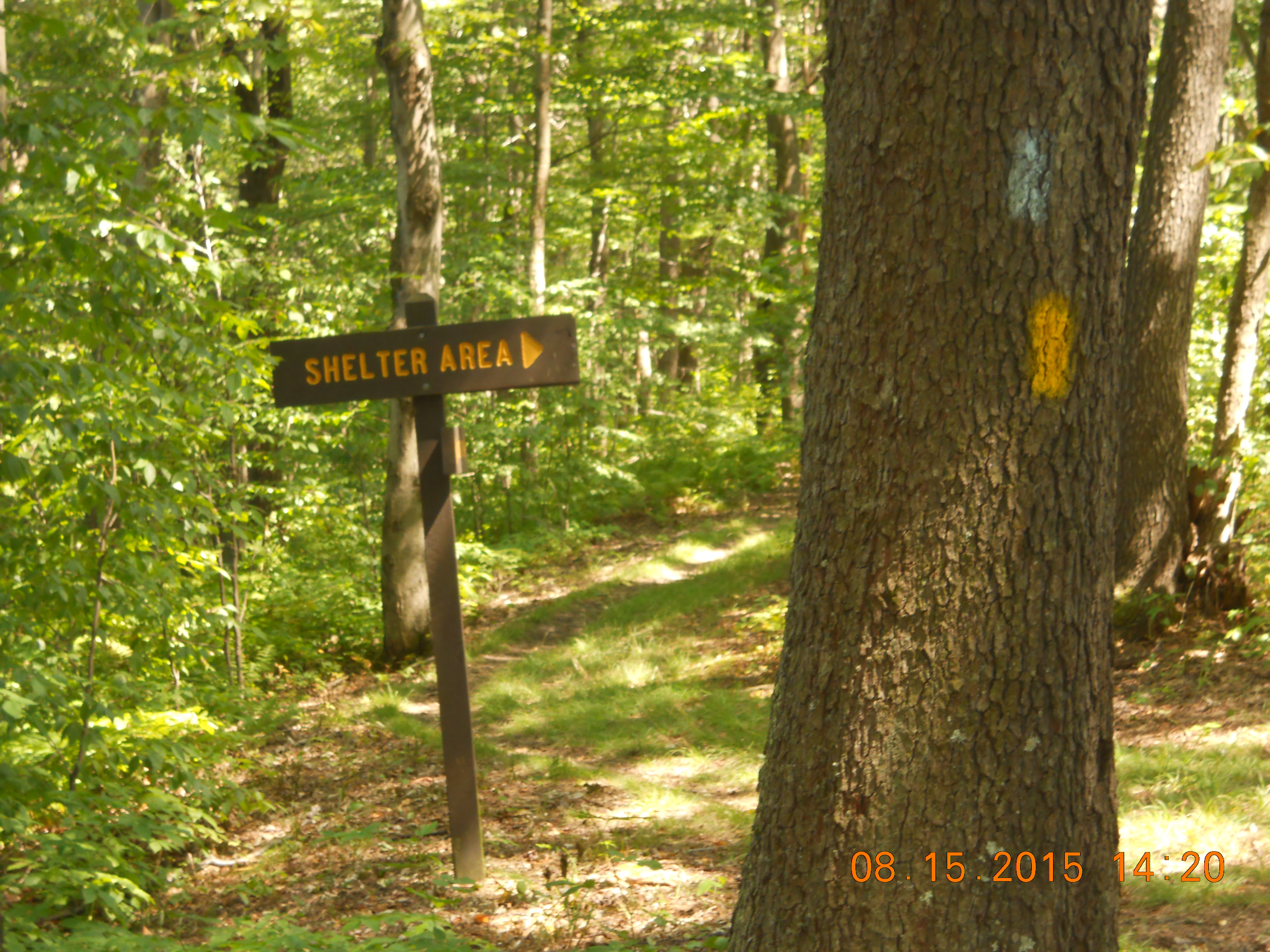
When you reach a shelter area, there are big, welcoming signs and now blue blazes that guide you to shelter, water, and pit toilets. It’s all so precise and organized that I feel gratitude for every person who carried a can of yellow or blue paint into the woods to make my life easier. Thank you, Department of Conservation and Natural Resources (DCNR).
I remember the first 30 miles of the trail to be hilly, including one monstrous 2 mile uphill climb around the 6 mile mark that was so steep, my knees should thank me for going UP not DOWN. The 15-mile section we just hiked had rolling hills, a few steep, but also miles of relative flatness.
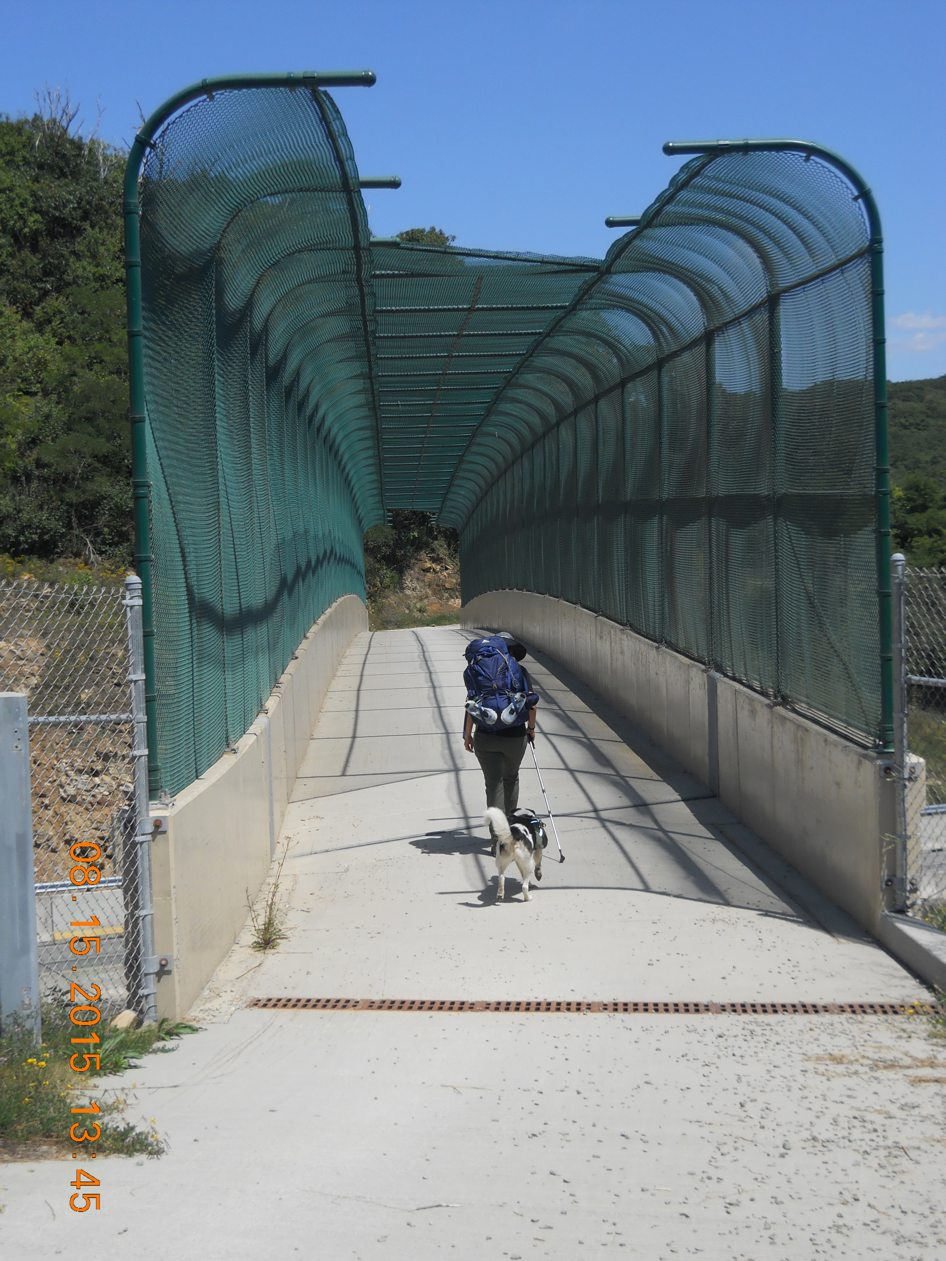
My favorite part of this trip was crossing the Pennsylvania Turnpike. You can hear zooming cars as you approach, and I kept wondering how we were going to cross this major highway. How fun to walk across the overpass and see cars zooming past. For just a few minutes, I appreciated the odd juxtaposition between people traveling both fast and slow to reach a destination and I was glad to be traveling slow.
We stayed at the Turnpike Shelter for the night. Somebody told us that the pump water at the Turnpike Shelter tasted “rusty.” Even after we filtered water from the pump, it still looked surprisingly cloudy. We boiled it before we used it for cooking, but we hesitated to drink it, so we hiked the next day with the water remaining in our camelbacks. We thought we had enough, but we drank every drop within ½ mile of our end point and could not have gone further without more water.

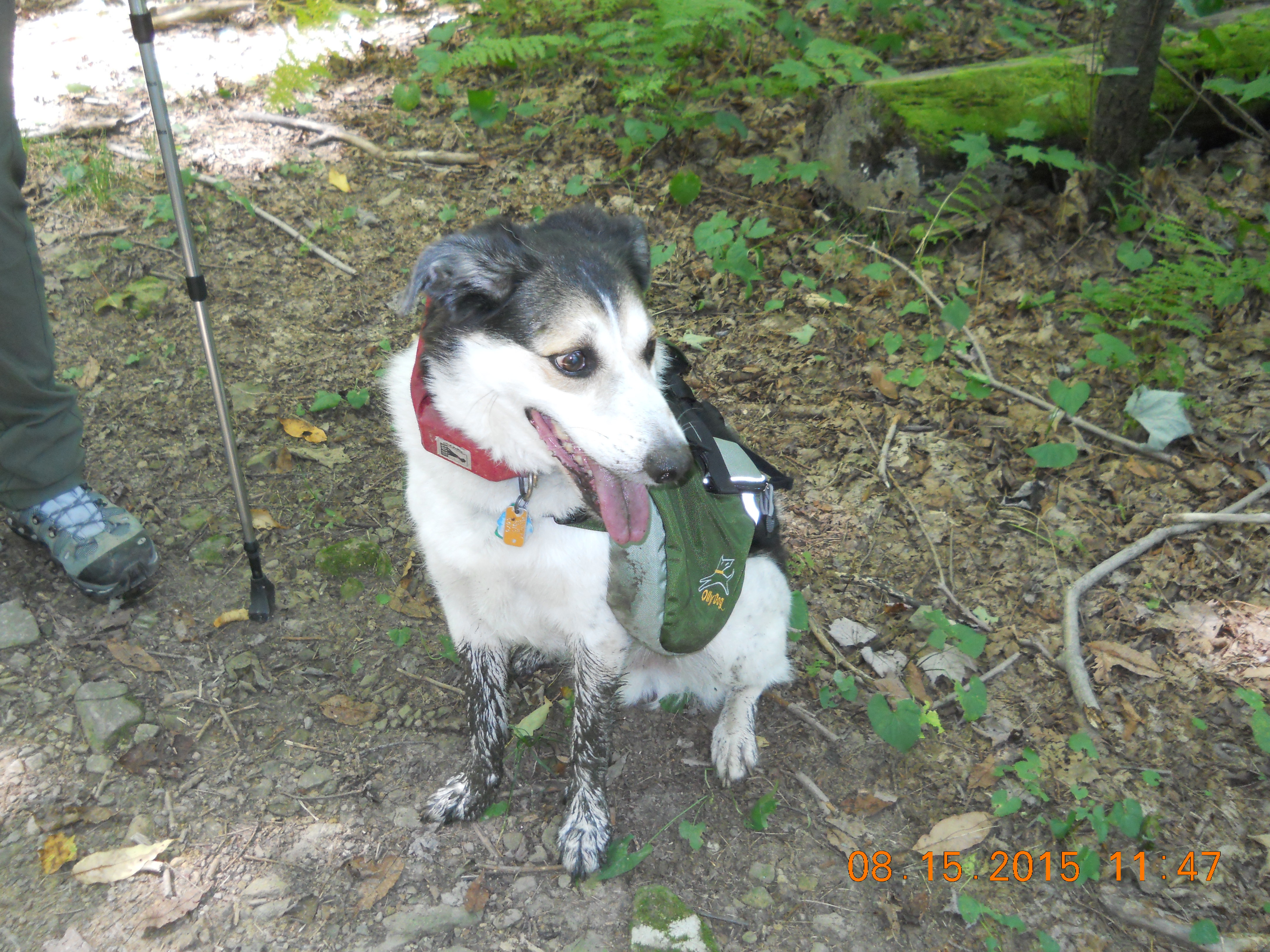
This is another difference between hiking the LHHT in May and August. A few months ago, there was plenty of water, lots of creeks and bubbling brooks. This time there was barely any water on the trail. In fact, on the first day, every creek bed was bone dry for 6 miles before we came upon any moisture, which turned out to be thick, black, muddy sludge, as Sparky discovered. (Notice forepaws.)
On the last trip, we met people who used those tube filters that you stick in a creek to suck up water. That makes sense when you know there’s going to be plenty of water available, but if anyone was using sippy straws on the trail this past weekend, I hope they had a Plan B or their kidneys could have been in trouble.
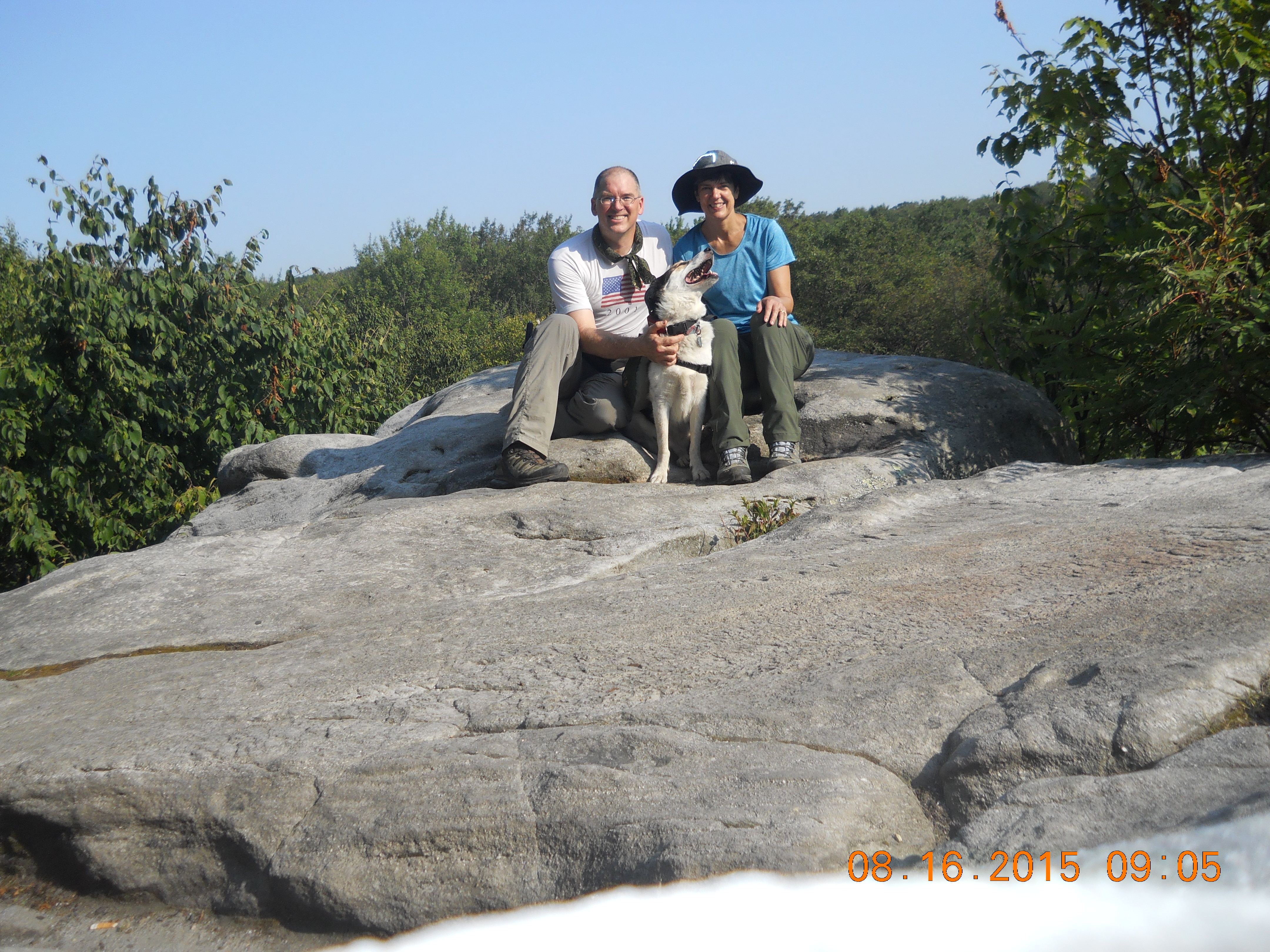
Day 2 we visited Beam Rock, which is around the 41 mile marker. The only significant thing I remember about the description of this site is that visitors should be careful because RATTLESNAKES like to sun themselves on the rocks. I was prepared to do my Wiggly Terror Dance, if necessary, but fortunately we didn’t run into any snakes.
So now we’ve hiked the first 46 miles with 24 miles to go. Next time, we’ll start at Route 30 and finish the 70 mile trail near Johnstown.
I’ll keep you posted.
***
By the way, WE FOUND THE ROUTE 31 TRAILHEAD.
If you read my first blog about backpacking on the LHHT, you will remember that we couldn’t find the overnight parking lot on Route 31, so we parked our end vehicle in a day-use-only lot, called the ranger mid-hike and hoped we wouldn’t reach the end to discover the DCNR towed our car. They were nice enough not to.
But in case you’re wondering, when you see the LHHT Parking sign on Route 31, turn in, IGNORE THE PARKING LOT ON THE RIGHT, keep driving straight on the bumpy, dirt road until you see another LHHT sign pointing to parking lot on the left.
Here’s a link to Part 1. Enjoy!
http://annkhowley.com/backpacking-the-laurel-highlands-hiking-trail-lhht-ohiopyle-to-route-31/